PDOP Value of BeiDou Satellite Navigation System, BeiDou Positioning Module

The actual constellation PDOP value of the Beidou satellite navigation system has reached the international leading level. The indicator parameters of a navigation constellation mainly include the number of available satellites in orbit and the Position Dilution of Precision (PDOP). The number of available satellites determines the coverage of the constellation's navigation signal, while PDOP is an important indicator used to measure the positioning accuracy of satellite navigation systems and the geometric strength of observation values, usually determined by the standard single point positioning observation equation.
The factor reflecting the attenuation of positioning accuracy is related to the spatial geometric distribution of the measured satellite. The larger the spatial distribution range, the smaller the PDOP value, and the higher the positioning accuracy; The larger the PDOP value, the lower the positioning accuracy. The Beidou system uses hybrid constellations to improve service performance on a regional scale while achieving global services. The actual PDOP of Beidou-3 is at a minimum of 1.3, with an average of 1.7, which is at the forefront of the world.
The BeiDou high-precision positioning module is a device that can achieve high-precision positioning, usually integrating relevant technologies of the BeiDou satellite navigation system. The following are some common characteristics and related information of BeiDou high-precision positioning modules:

1. High precision positioning: It can provide centimeter or even millimeter level positioning accuracy, meeting the application scenarios that require high positioning accuracy.
2. Multi system support: In addition to the Beidou system, it may also support other satellite navigation systems such as GPS and GLONASS to improve the reliability and accuracy of positioning.
3. Small size, low power consumption: Easy to integrate into various devices while reducing device energy consumption.
4. Quick positioning: With fast initial positioning time and recapture time.
5. High sensitivity: able to maintain good positioning performance even in weak satellite signal environments.
The application fields are very extensive, including but not limited to the following aspects:
1. Intelligent driving: providing precise location information for vehicles, assisting in the implementation of functions such as autonomous driving.
2. Precision agriculture: used for navigation and control of agricultural machinery, achieving precise seeding, fertilization, irrigation and other operations.
3. Drones: Ensure stable flight and precise operation of drones, such as aerial photography, pesticide spraying, etc.
4. Surveying: Performing high-precision mapping, cadastral surveying, and other work.
5. Shared bike: Helps users find and return cars more accurately, while facilitating vehicle management for operating enterprises.
6. Logistics transportation: Real time tracking of the location of logistics vehicles, optimizing transportation routes and scheduling.
7. Public safety: For example, it is used in some security monitoring devices to achieve precise positioning of specific targets.
8. Industrial automation: applied to automation equipment, robots, etc. in factories to improve production efficiency and accuracy.
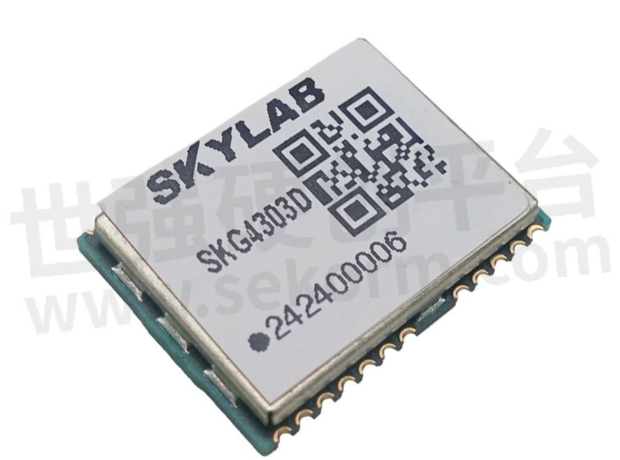
There are many different models and brands of Beidou high-precision positioning modules available for selection in the market. For example, SKYLAB's SKG4303D dual frequency single BeiDou navigation and positioning module integrates SOC baseband and RF integrated chip inside the module. The chip has a single BeiDou certification certificate and can support BDSB1I+B1C+B2A frequency points, fully supporting the BeiDou three signals. It can provide users with strong anti-interference, low power consumption, and high-quality positioning and navigation solutions.
When selecting the high-precision positioning module of Beidou, the following factors need to be considered: positioning accuracy, sensitivity, supported satellite systems, data update rate, interface type, operating temperature range, power consumption, size, cost, etc., to meet the specific application requirements. At the same time, attention should also be paid to the stability and reliability of the module, as well as the technical support and after-sales service of the supplier.
- +1 Like
- Add to Favorites
Recommend
- What are the Functions of the Smart Construction Site Personnel Positioning System?
- How To Choose The Smart Home IoT WiFi Module?
- SKYLAB and MMC developed Long-endurance UAV Power Line Patrol Automatic Solution
- SKYLAB provides UAV Petrochemical Pipeline Inspection Solution
- SKYLAB launched a GPS positioning system solution for Logistics truck GPS Positioning Tracking Application
- SKYLAB GPS positioning technology help people solve the problem of lost pets and find their pets faster,more conveniently
- SKYLAB‘s Parking Lot Bluetooth Positioning and Navigation Solution
- Skylab lanuched a 1.8μA Ultra Low Energy Bluetooth Module SKB378 for Smart Home
This document is provided by Sekorm Platform for VIP exclusive service. The copyright is owned by Sekorm. Without authorization, any medias, websites or individual are not allowed to reprint. When authorizing the reprint, the link of www.sekorm.com must be indicated.


