Introduction to TWR Active and Passive Positioning Systems, UWB Positioning Technology

The TWR positioning system is a common ranging and positioning technology that uses interaction and distance measurement between multiple nodes to further determine the position coordinates of each node using geometric principles. The TWR positioning system has certain accuracy and reliability and has applications in specific scenarios such as indoor positioning and wireless sensor network positioning.
The TWR active positioning system architecture includes UWB Anchors and UWB tags.

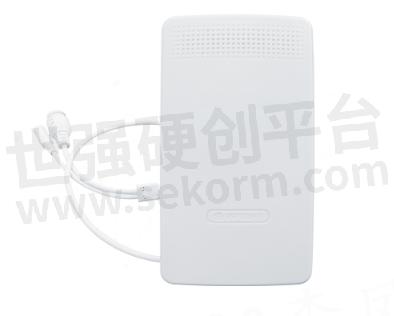
DW1000 UWB TWR Ranging Anchor VDU2506
(1) UWB Anchor: installed on robots or other devices that require positioning. The Anchor emits UWB signals, ranging from known coordinates to each other, and solves the positioning of the Anchor itself through the Anchor positioning algorithm.
(2) UWB tag: The TWR active positioning system requires the installation of UWB positioning tag in the positioning area in advance. UWB Anchors communicate through UWB signals and tag to achieve the function of locating UWB Anchor.
TWR active positioning, where the mobile Anchor measures the distance of stationary labels one by one through polling. The Anchor sends a distance measurement request and immediately receives a reply from the tag to calculate the distance between pairs. After the distance measurement is completed in this round, the Anchor sends the tag ID and its corresponding distance to STM32F4 for coordinate calculation or distance filtering calibration and outputs the calculation results through the USB interface.
The TWR active positioning system is suitable for automatic calibration of robot motion trajectories. Four UWB tags can form a basic UWB positioning system. The tag does not require networking and time synchronization, and stable high-precision two-dimensional positioning can be achieved with a power supply. Therefore, the hardware deployment cost of the positioning system will be greatly reduced.
TWR passive positioning system
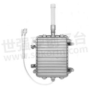
The TWR passive positioning system is similar to TDOA. After measuring the distance between the Anchor and the tag, the Anchor uploads the distance information to the backend reset device, and the server parses the position information.

Outdoor UWB Asset Positioning Anchor VDU2508
The advantage of TWR positioning system lies in the fact that there is no need for time synchronization between Anchors and work cards. Moreover, the distance of TWR ranging is much longer than that of TDOA receiving, and it can achieve kilometer level ranging. The TWR positioning system architecture is divided into four layers, namely the object layer, acquisition layer, processing layer, and presentation layer.
(1) The object layer includes people, objects, places, and events, namely the supervised personnel and objects. Real time positions are obtained through positioning electronic markers, and if an alarm occurs, video linkage can be used.
(2) The positioning electronic bracelet, positioning card, and item label of the collection layer are worn on personnel or fixed on items as wireless data transmission modules, and can be used as the front-end of data collection to send positioning data on a scheduled basis; Positioning Anchors, perception devices, network devices, etc. are responsible for uploading real-time information data of electronic wristbands, positioning cards, and item labels to the processing layer for position calculation, data analysis, etc.
(3) The business layer includes a positioning engine server, a data server, and a business server. The server is responsible for location calculation, data analysis, data auditing, and other work.
(4) The B/S architecture of the display layer allows for graphical display of the current positions of personnel and items on the location map through the client after wearing an electronic wristband or positioning card. The initialization of system positioning data, business process management, user management, data queries, etc. are all implemented through a browser.
- +1 Like
- Add to Favorites
Recommend
This document is provided by Sekorm Platform for VIP exclusive service. The copyright is owned by Sekorm. Without authorization, any medias, websites or individual are not allowed to reprint. When authorizing the reprint, the link of www.sekorm.com must be indicated.


