UWB Positioning Application Solution for VR/AR Game

In recent years, VR/AR has been widely used in many fields. VR is virtual reality technology, which uses technological means to simulate a virtual scene similar to reality so that people can get an immersive experience in many aspects such as vision and hearing. AR stands for augmented reality technology, which uses technological means to combine virtual scenes with real situations to effectively enhance people's perception capabilities.
With the further development of VR/AR technology, the application in-game production, business services, and other fields have become more and more in-depth, bringing people a very real sense of presence. To achieve better interactive effects, the high-precision positioning system has become one of the key factors.
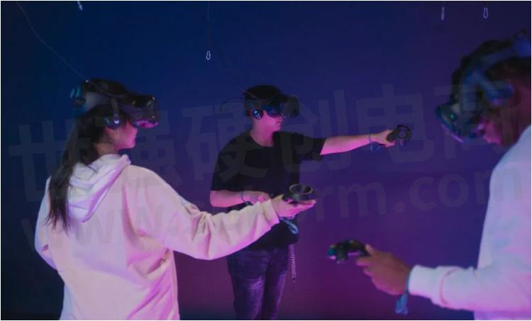
SKYLAB(天工测控) has developed and launched the UWB high-precision navigation and positioning system. It only needs to set up 4 base stations and wear relevant rated position tags to achieve high-precision positioning for indoor games. Pain points such as expensive price.
VR/AR Game UWB Positioning Principle
VR/AR game UWB high-precision positioning system, by installing a base station at a fixed reference point in the game area, installing a positioning tag on the tracked object, or wearing a positioning tag on the tracked character, so as to realize the positioning of each positioning tag. , and then use the built-in IMU and vision of the helmet device to fuse the positioning information to obtain a smoother and more accurate positioning effect.
VR/AR Game UWB Positioning System Architecture
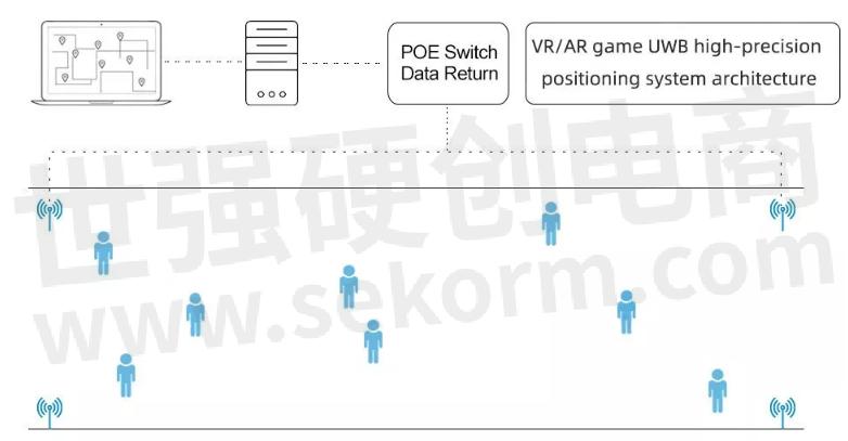
The UWB personnel positioning system management system in VR/AR games consists of a display terminal, UWB positioning engine, UWB positioning label, and UWB positioning base station.
(1) Display terminal: The coordinates of the positioning tag calculated by the UWB positioning engine should be displayed on the display terminal (PC, tablet computer, mobile phone).
(2) UWB positioning engine: The UWB positioning base station in the game positioning area sends the original position data to the UWB positioning engine through the network in real-time, and then the UWB positioning engine runs the positioning algorithm to calculate the coordinate position of the person wearing the UWB positioning tag in real-time.
(3) UWB positioning tag: equip the personnel and equipment to be located with UWB positioning tags, the positioning tags transmit UWB signals, and communicate with the UWB positioning base station, so that the tags themselves can be located. The UWB positioning tag can be a wristband type, a badge type, or a module type fixed on a helmet.
(4) UWB positioning base station: The UWB positioning base station communicates with the positioning tag through the UWB signal, and then calculates through the background server-side positioning engine to realize the precise positioning function of the UWB positioning tag.
UWB Positioning Management System Interface
According to the design of the UWB positioning system architecture, the connection, data interaction, business processing, etc. between the various functional subsystems are implemented and managed by the interface subsystem. The main interfaces are as follows, as shown in the figure below:
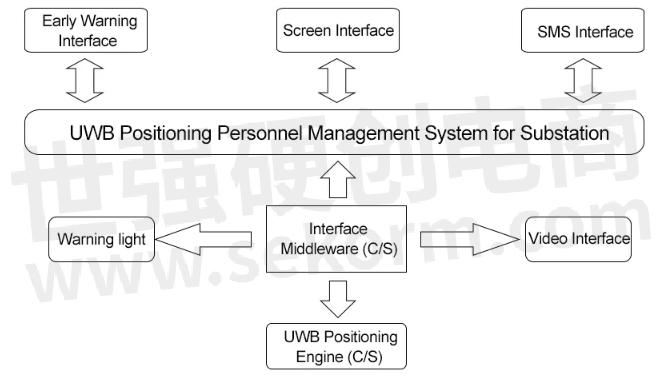
(1) API interface of positioning engine data
(2) Docking interface with sound and light alarm
(3) Docking interface with monitoring display
(4) Docking interface with alarm subsystem
(5) Interface with surveillance video
Introduction of UWB Positioning Products
Support protocol: compatible with IEEE802.15.4-2011 UWB protocol
Frequency:default 3774~4243.2MHz, Support channel ch1-5
Typical transmit power:-6dBm/500MHz (CH2)
Receive sensitivity:-105dBm(packet loss rate 10%,CH2)
Data transmission rate:Default 6.8Mbps Support 110Kbps,850kbps
Positioning accuracy:<30cm
Data upload method: 100Mbps Ethernet
Base station clock synchronization method: UWB wireless synchronization
DC power supply: input voltage 5.0V (4.5~ 5.5V), input power greater than 1W
POE power supply:standard: Cat.5 and above (POE output power is greater than 1W)
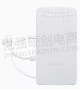
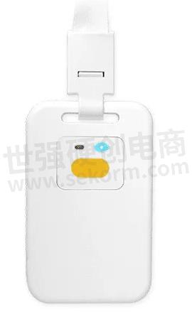
b) UWB Positioning Cards VDU1501
Master Control Chip: Nordic nRF 52832
Positioning Chip: Decawave DW1000 chips
Location Algorithm: TDOA
Positioning Accuracy: 10cm
Button: Configure the SOS button, Emergency problems can be avoided by the alarm for help
Use Time of Charging Once: 2 months(1Hz positioning) The Default Frequency Range is 3774-4243.2MHz.
Support Channel: modifiable, support channel ch1-5
Protocol Standard: EEE 802.15.4- 2011UWB
Movement Refresh Frequency: 10Hz(Default, modifiable)
Static Refresh Frequency: 1Hz(Default, modifiable)
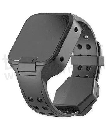
c) UWB Positioning Watch VDU1502
Main control chip: Nordic nRF52832
Positioning chip: Decawave DW1000
Supported channels can be modified to support channels ch1-5 Positioning accuracy: up to 10cm
Use time for one charge: about 2 months (1Hz positioning) Movement refresh frequency 10Hz (default, can be modified)
Static refresh frequency 1Hz (default, can be modified)
Protection: Waterproof design
Positioning mode: positioning and smart power-saving mode
Health function: real-time monitoring of the wearer's heart rate, steps, display time
Press the button: configure the SOS button, you can call for help and alarm in an emergency
Category: tamper-proof type without a screen, tamper-proof type with screen, non-tamper-proof type with screen, and non-tamper-proof type without screen
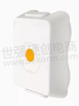
RF: Decawave DW1000
Master: Nordic nRF52832
Positioning/Ranging Accuracy: CEP90, 30cm
Positioning algorithm: support TDOA positioning and TWR ranging
Use time: one full charge, TDOA positioning is 3.8 months (default1Hz); TWR ranging 28.3 days (default 1Hz)
Charging method: charging head magnetic charging
Positioning distance: TWR ranging: 1000 meters
Protection grade: IP66 waterproof and dustproof
Alarm: integrated SOS button, emergency use
Installation: two ways (1) fixed with holes and screws (2) 3M glue
Function: personnel positioning, social distance detection
occasion: construction site, coal mine, tunnel, pipe gallery, mine
- +1 Like
- Add to Favorites
Recommend
- What are the Functions of the Smart Construction Site Personnel Positioning System?
- SKYLAB‘s Restaurant Personnel UWB Positioning Project
- How To Choose The Smart Home IoT WiFi Module?
- SKYLAB Has Developed A Fire Uwb Personnel Positioning System In Fire Rescue Applications
- SKYLAB and MMC developed Long-endurance UAV Power Line Patrol Automatic Solution
- SKYLAB provides UAV Petrochemical Pipeline Inspection Solution
- UWB Positioning Solution for Power Plant Substation Workers
- SKYLAB launched a GPS positioning system solution for Logistics truck GPS Positioning Tracking Application
This document is provided by Sekorm Platform for VIP exclusive service. The copyright is owned by Sekorm. Without authorization, any medias, websites or individual are not allowed to reprint. When authorizing the reprint, the link of www.sekorm.com must be indicated.


